| AltRefNo | Rocque map 1746 |
| Title | [Section from John Rocque's London map of 1746 showing the eastern part of Marylebone between Oxford Street to the south and Tottenham Court Road to the East] |
| Date | 1746 |
| Thumbnail | 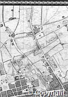
|
| Access Status | Open |
Show related Persons records.
Persons
| Code | PersonName | Dates |
| NA231 | Rocque; John (c1709-1762); surveyor and cartographer | c1709-1762 |
Places
| Code | Set |
| PL1097 | Cavendish Sq/St Marylebone |
| PL553 | Oxford St/St Marylebone |
| PL845 | Tottenham Court Rd/St Marylebone |